
Weather Report forecast of 29 September 2011 India - Live

MAIN WEATHER OBSERVATIONS (Recorded during past 24 hours):
♦ The withdrawal line of Southwest monsoon passes through Lat.28.0°N/Long.82.0°E, Bahraich, Lucknow, Jhansi, Bhopal, Indore, Baroda and Veraval, Lat. 21.0°N / Long. 65.0°E and Lat. 21.0°N / Long. 60.0°E.
♦ From 0830 to 1730 hours IST of yesterday, fairly widespread rainfall occurred over Andaman & Nicobar islands; isolated over northeastern states, Madhya Maharashtra, Andhra Pradesh, Bihar, north interior Karnataka, Weather remained mainly dry over rest of the country. The chief amounts of rainfall (1 cm and above) recorded at 1730 hours IST of yesterday were: Hutbay-6, Pune and Ongole-2 each, Car Nicobar, Maya Bandar, Purnea and Gulbarga-1 each.
Warning:
♦ No weather warning.
Weather Report forecast of 26 September 2011 India - Live

Live weather report forecast of 26 September 2011 India:
Monsoon Watch:
♦ Southwest monsoon has further withdrawn from entire Jammu & Kashmir,
Himachal Pradesh, Uttarakhand, Delhi, remaining parts of Punjab, Haryana, some more
parts of Rajasthan and some parts of west Uttar Pradesh.
♦ The withdrawal line passes through Lat.29.0°N/Long.80.0°E, Bareilly, Agra, Sawai
Madhopur, Udaipur, Deesa, Porbandar, Lat. 21.0°N / Long. 65.0°E and Lat. 21.0°N /
Long. 60.0°E.
Main Weather Observations:
♦ From 0830 to 1730 hours IST of today, widespread rainfall has occurred over SubHimalayan
West Bengal & Sikkim; scattered over Bihar and isolated over northeastern states, west Madhya
Pradesh, Jharkhand, Gangetic West Bengal, Marathawada, coastal Andhra Pradesh, Tamilnadu
and Andaman & Nicobar Islands. Weather remained mainly dry over rest parts of the country.
The chief amounts of rainfall (1 cm and above) recorded at 1730 hours IST of today are:
Jalpaiguri9, Balurghat5, Bapatla4, Gangtok, Tadong and Maya Bandar3 each, Malda2 and
Patna and Coochbehar1 each.
♦ Kalpana1 cloud imagery at 1730 hours IST shows convective clouds over parts of northeast
Bihar, SubHimalayan West Bengal & Sikkim, west Assam, southeast Bay of Bengal and
Comorin area. Low/medium clouds are seen over remaining parts of the country outside
Punjab, Haryana, Rajasthan and Uttar Pradesh
Weather Warning:
♦ Scattered heavy to very heavy rainfall would occur over Bihar and SubHimalayan
West Bengal & Sikkim during next 24 hours and isolated heavy thereafter.
♦ Isolated heavy rainfall would occur over Assam, Meghalaya and Arunachal
Pradesh during next 48 hour
Weather Report forecast of 25 September 2011 India - Live

Monsoon Watch
♦ Yesterday the southwest monsoon had withdrawn from some parts of Punjab, Haryana, Rajasthan, Gujarat and north Arabian Sea.The withdrawal line passes through Amritsar, Hissar, Ajmer, Deesa, Porbandar, Lat.21.0°N/Long.65.0°E and Lat.21.0°N/60.0°E.
♦ From 0830 hours IST to 1730 hours IST of yesterday, widespread rainfall occurred over Jharkhand; fairly widespread over Bihar, SubHimalayan West Bengal & Sikkim and Andaman & Nicobar Islands; scattered over northeastern states, east Uttar Pradesh, Chhattisgarh, Orissa and Gangetic West Bengal; Isolated over Gujarat region, Vidarbha, Andhra Pradesh and west Uttar Pradesh and weather remained mainly dry over rest of the country. The chief amounts of rainfall (2 cm and above) recorded at 1730 hours IST of yesterday were: Mayabander-8, Daltonganj-4, Sultanpur, Ambikapur, Rewa and Long Island-3 each and Ranchi, Jamshedpur, Jharsuguda, Churk, Hut Bay and Ghazipur-2 each
Warning
♦ Isolated heavy rainfall would occur over east Uttar Pradesh, north Chhattisgarh, Jharkhand,
Bihar, sub Himalayan West Bengal & Sikkim, Assam and Meghalaya during next 48 hours.
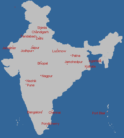
Current Temperature of Indian Cities-Live
Click on the city name for the current temperature of that city:
Weather Report forecast of 24 September 2011 India - Live
Warnings on 24-September 2011:

Monsoon Watch:
♦ The southwest monsoon has withdrawn from some parts of Punjab, Haryana, Rajasthan, Gujarat and north Arabian Sea.The withdrawal line passes through Amritsar, Hissar, Ajmer, Deesa, Porbandar, Lat.21.0°N/Long.65.0°E and Lat.21.0°N/60.0°E.
♦ From 0830 hours IST of yesterday to 0830 hours IST of today, widespread rainfall has occurred over Gangetic West Bengal, Andaman & Nicobar Islands; fairly widespread over Bihar, SubHimalaya West Bengal & Sikkim, northeastern states, Jharkhand and Orissa; scattered over east Uttar Pradesh, Chhattisgarh, Konkan & Goa and Kerala and isolated over Uttarakhand, west Uttar Pradesh, Gujarat region, Madhya Pradesh, interior Maharashtra, Telangana, coastal Andhra Pradesh, coastal Karnataka, south interior Karnataka and Tamilnadu. Weather remained mainly dry over rest of the country. The chief amounts of rainfall (3 cm and above) recorded at 0830 hours IST of today are: Keonjhargarh-19, Ranchi-9, Dehrionsone-8, Sundergarh-6, Silchar, Cherrapunji, Golaghat, Jamshedpur, Hirakud, Sambalpur, Jharsuguda and Churk-5 each, Gaya and Daltonganj-4 each, Gangtok, Guwahati, Chaibasa, Haldia, Kolkata, Contai, Champa, Bhawani Patna, Baripada, Port Blair, Car nicobar and Hut Bay-3 each.
Warning:
♦ Isolated heavy rainfall would occur over east Uttar Pradesh, north Chhattisgarh, Jharkhand,
Bihar, sub Himalayan West Bengal & Sikkim, Assam and Meghalaya during next 48 hours.
Weather Report forecast of 23 September 2011 India - Live

Detailed Weather Report and forecast of the Day(23 September 2011):
Monsoon Watch:
♦ Mainly dry weather continues to prevail over Punjab, Haryana, west Rajasthan and
Saurashtra & Kutch during last 3 days. An anticyclonic circulation has developed over
Rajasthan and neighbourhood at 1.5 Km above mean sea level. Analysis of satellite
imageries shows dry air prevalence over Punjab, Haryana and west Rajasthan during
last 3 days. Interpretation of current meteorological conditions indicates dry weather
would prevail over above regions during next 45 days, therefore monsoon is likely to
withdraw from parts of northwest India during next 48 hours
Synoptic Features:
♦ The depression over northwest Bay of Bengal and adjoining coastal areas of north Orissa and Gangetic
West Bengal moved slightly westwards and lay centred at 1430 hours IST of today over northwest Bay of
Bengal about 25 km eastsoutheast of Balasore. It is likely to move westnorthwestwards and cross Orissa
West Bengal coast close to Balasore by today evening.
♦ The western end of monsoon trough runs close to foot hills of Himalayas and its eastern end passes
through Khiri, Varanasi, Daltonganj, Jamshedpur, centre of depression and thence southeastwards to
eastcentral Bay of Bengal.
Weather Report forecast of 22 September 2011 India - Live
Warnings:

Detailed Weather Report and forecast of the Day(22 September 2011):
Monsoon Watch
♦ During past 24 hours, weather remained mainly dry over Punjab, Haryana, west Rajasthan and
Saurashtra & Kutch. Analysis of current meteorological conditions indicate development of anticyclonic circulation in lower tropospheric levels over Rajasthan and neighbourhood during next 48 hours. Further,analysis of satellite imageries also indicates dry air prevalence over Punjab, Haryana and west Rajasthan during last 2 days. These conditions are favorable for withdrawal of Southwest Monsoon from parts of northwest India after 23 days.
Main Weather Observations
♦ From 0830 to 1730 hours IST of today, fairly widespread rainfall has occured over Gangetic West Bengal, Assam and Arunachal Pradesh; scattered over sub Himalayan West Bengal & Sikkim, Bihar, Orissa,Meghalaya, Nagaland, Manipur, Mizoram, Tripura, along west coast and, Andaman & Nicobar and isolated over
Uttrakhand, Uttar Pradesh, east Rajasthan, Jharkhand, Chhattisgarh, Vidarbha, Madhya Pradesh, Madhya
Maharashtra, interior Karnatka, Gujarat region, Rayalseema and Lakshadweep and mainly dry over remaining
parts of the country. The chief amounts of rainfall (2 cm and above) recorded at 1730 hours IST of today are:
Chandbali and Long Island4 each; Lumding, Honavar, Mayabandar and Midnapur3 each; Mukteshwar, Tangla,
Bhagalpur, Keonjhargarh, Agumbe, Bankura, Mumbai (Colaba), Mahabaleshwar and Madurai2 each.
♦ Kalpana-1 cloud imagery at 1730 hours IST shows convective clouds over parts of Chhattisgarh,northeastern states and east India, Kerala, Tamilnadu, north & central Bay of Bengal, north Andaman Sea and southeast Arabian Sea. Low/medium clouds are seen over remaining parts of the country outside Punjab, Haryana, west Rajasthan, west Uttar Pradesh and Saurashtra & Kutch.
Earthquake Warnings in India
The India has a history of many earthquakes. The major reason for the high frequency and intensity of the earthquakes is that India is driving into Asia at a rate of approximately 47 mm/year. Geographical statistics of India shows that almost 54% of the land is vulnerable to earthquakes. The latest version of seismic zoning map of India given in the earthquake resistant design code of India assigns four levels of seismicity for India in terms of zone factors. In other words, the earthquake zoning map of India divides India into 4 seismic zones (Zone 2, 3, 4 and 5) unlike its previous version which consisted of five or six zones for the country. According to the present zoning map, Zone 5 expects the highest level of seismicity whereas Zone 2 is associated with the lowest level of seismicity. The latest seismic zoning map can be accessed from govt website.
The MSK ( Medvedev - Sponheuer - Karnik ) intensity broadly associated with the various seismic zones is for Zones 2, 3, 4 and 5, corresponding to Maximum Considered Earthquake. The IS code follows a dual design philosophy: (a) under low probability or extreme earthquake events (MCE) the structure damage should not result in total collapse, and (b) under more frequently occurring earthquake events, the structure should suffer only minor or moderate structural damage. The specifications given in the design code are not based on detailed assessment of maximum ground acceleration in each zone using a deterministic or probabilistic approach. Instead, each zone factor represents the effective period peak ground accelerations that may be generated during the maximum considered earthquake ground motion in that zone.
Each zone indicates the effects of an earthquake at a particular place based on the observations of the affected areas and can also be described using a descriptive scale like Modified Mercalli intensity scale or the Medvedev - Sponheuer - Karnik scale.
Zones:
Zone-5:
Zone 5 covers the areas with the highest risks zone that suffers earthquakes of intensity MSK IX or greater. The IS code assigns zone factor of 0.36 for Zone 5. Structural designers use this factor for earthquake resistant design of structures in Zone 5. The zone factor of 0.36 is indicative of effective (zero period) peak horizontal ground accelerations of 0.36 g (36 % of gravity) that may be generated during MCE level earthquake in this zone. It is referred to as the Very High Damage Risk Zone. The state of Kashmir, Punjab,the western and central Himalayas, the North-East Indian region and the Rann of Kutch fall in this zone.The capital of India, Delhi,also lies in this zone.
Zone-4:
This zone is called the High Damage Risk Zone and covers areas liable to MSK VIII. The IS code assigns zone factor of 0.24 for Zone 4. The Indo-Gangetic basin and the capital of the country (Delhi), Jammu and Bihar fall in Zone 4. In Maharashtra Patan area(Koyananager) also in zone 4.
Zone-3:
The Andaman and Nicobar Islands, parts of Kashmir, Western Himalayas fall under this zone. This zone is classified as Moderate Damage Risk Zone which is liable to MSK VII. and also 7.8 The IS code assigns zone factor of 0.18 for Zone 3.
Zone-2:
This region is liable to MSK VI or less and is classified as the Low Damage Risk Zone. The IS code assigns zone factor of 0.10 (maximum horizontal acceleration that can be experienced by a structure in this zone is 10 % of gravitational acceleration) for Zone 2.
Weather Report of 21 September 2011 India - Live
Detailed Weather Report of the Day(21 September 2011):
Monsoon Watch
♦ Monsoon would remain active over east and northeast India during next 4-5 days.
Main Weather Observations
♦ From 0830 hours IST of yesterday to 0830 hours IST of today, widespread rainfall has occured over Andaman & Nicobar Islands; fairly widespread over Bihar, SubHimalayan West Bengal & Sikkim, Chhattisgarh, coastal Karnataka and Kerala; scattered over east Rajasthan, Gangetic West Bengal, Jharkhand, Orissa, Konkan & Goa, Rayalaseema, south interior Karnataka, Tamilnadu and Lakshadweep and isolated over remaining parts of the country outside Uttarakhand, Haryana, west Uttar Pradesh, Saurashtra & Kutch, Vidarbha and Marathawada where weather remained mainly dry. The chief amounts of rainfall (3 cm and above) recorded at 0830 hours IST of today are: Bangalore (Airport)-8,Mujaffarpur, Kolkata (DumDum) and Vellore-7 each, Patna, Banglore and Chennai-6 each, Chennai (Numgambakkam) and Cuddalore-5 each, Sriganganagar and Udhagamandalam-4 each and Jaipur, Banda, Malda, Balasore, Bhawanipatna, Tirupathi, Alapuzha, Arogyavaram and Long Island-3 each.
Weather Warnings 20 September 2011 India - Live
The following areas where warning was given due to bad weather conditions in India on 20 September 2011:
♦ Isolated heavy to very heavy rainfall would occur over Bihar and SubHimalayan West
Bengal & Sikkim during next 24 hours.
♦ Isolated heavy rainfall would occur over Gangetic West Bengal, Orissa, Assam, Meghalaya,
Arunachal Pradesh, Nagaland, Manipur, Mizoram and Tripura during next 48 hours
Weather Report of 20 September 2011 India - Live
Detailed Weather Report of the Day(20 September 2011):
Monsoon Watch
♦ Conditions are becoming favourable for withdrawal of monsoon from parts of Rajasthan after 3-4 days.
♦ Monsoon would remain active over east and northeast India during next 4-5 days.
Main Weather Observations
♦ From 0830 hours IST of yesterday to 0830 hours IST of today, widespread rainfall occured over West Bengal
& Sikkim, Bihar, Konkan & Goa and coastal Karnataka; fairly widespread over Jharkhand, Orissa, northeastern
states, Lakshadweep and Andaman & Nicobar Islands; scattered over east Rajasthan, Gujarat, Chattisgarh and
interior Karnataka and isolated over remaining parts of the country. The chief amounts of rainfall (4 cm and
above) recorded at 0830 hours IST of today are: Siliguri (Bagdogra)-12, Purnea and Kalimpong-11 each,
Balurghat-9, Mangalore (Bajpe) and Manglore (Panambur)-8 each, Darjeeling-7, Jalpaiguri and Mayabandar-5
each and Honavar and Baripada-4 each.
Weather Forecast Warning 19 September 2011 India - Live
The following areas where warning was given due to bad weather conditions in India on 19 September 2011:
♦ Isolated heavy to very heavy rainfall would occur over Bihar and Sub-Himalayan West Bengal & Sikkim during next 48 hours.
♦ Isolated heavy rainfall would occur over Gangetic West Bengal, Jharkhand, Assam, Meghalaya, Arunachal Pradesh, Nagaland, Manipur, Mizoram and Tripura during next 48 hours.
Weather Report 19 September 2011 India - Live
Detailed Weather Report of the Day(19 September 2011):
♦ Conditions are becoming favourable for withdrawal of monsoon from parts of Rajasthan after 4-5 days.
♦ Monsoon would remain active over east and northeast India during next 2-3 days.
♦ From 0830 to 1730 hours IST of today, widespread rainfall has occured over Sub-Himalayan West Bengal and Sikkim, Bihar and coastal Karnataka, fairly widespread over Assam and Meghalaya Gangetic West Bengal and Jharkhand, scattered over east Uttar Pradesh, Orissa and east Rajasthan and Isolated over rest of the country outside Punjab, Haryana, Tamilnadu, Uttarakhand and Jammu & Kashmir where weather remained mainly dry. The chief amounts of rainfall (2 cm and above) recorded at 1730 hours IST of today are: Siliguri-10, Purnea, Jalpaiguri and Honavar-3 each and Varanasi, Gangtok, Majbat,Tadong, Bankura, Jagdalpur, Balurghat, Burdwan, Agumbe, Karwar and Mayabandar-2 each.
Live temperature in Lucknow
Todays minimum and maximum temperature of Lucknow:
Lucknow is a famous city in UP,India,famous for its Nawabs.
Nagpur Live Temperature-Weather-Forecast
Todays minimum and maximum temperature of Nagpur :
Weekly Weather Forecast of Nagpur:
Nagpur is a famous industrial city of India.
Jabalpur Live Temperature-Weather-Forecast
Todays minimum and maximum temperature of Jabalpur :
Jabalpur is a district in Madhya Pradesh,many IT professionals are comming now a days from Jabalbur.Its climate is pleasent and nice.
Jamshedpur Live Temperature-Weather-Forecast
Today minimum and maximum temperature of Jamshedpur :
Jamshedpur is the famous city of Jharkhand. It is know for its steel industries and aslo know as TATA city.
Jamshedpur is the famous city of Jharkhand. It is know for its steel industries and aslo know as TATA city.
Colombo Live Temperature-Weather-Forecast
Todays minimum and maximum temperature of Colombo
Colombo City is the capital of Sri Lanka and is a very good tourist place too.It is the political center of Sri Lanka.
Kathmandu Live Temperature-Weather-Forecast
Todays minimum and maximum temperature of Kathmandu
Kathmandu is the capital city of Nepal.It is a very beautiful city to visit.Its temperature is also very pleasant always.It is famous for its natural beauty.
Karachi Live Temperature-Weather-Forecast
Todays minimum and maximum temperature of Karachi (Pakistan)
Karachi is a famous city of Pakistan.It is well know for the political activities and area of the city. It is the largest city of Pakistan as well.
Indore Live Temperature-Weather-Forecast
Todays minimum and maximum temperature of Indore :
Indore is a beautiful city of Madhya Pradesh.It is located at some distance from Bhopal that is the capital of the state.Bhopal is famous for its Lakes and Indore is having a well suited climate.